


Second campaign on Mount Stallberg (Summer 2017, near Fulda)
The first excavation campaign on Mount Stallberg took place during the summer of 2016. The focus was on questions regarding the general use of the plateau and the existence of a possible settlement and their respective chronological attribution. For the second campaign the main focus shifted towards the construction and dating of the stone wall, which encloses the top of the mount.
| The excavations took place between the 21st of August and the 8th of September 2017. As in the previous year, our research was conducted in cooperation with Dr. Frank Verse, head of the Stadt- und Kreisarchäologie Fulda, and the SPAU excavation company from Münzenberg. This year, 6 trenches were opened through and next to the collapsed wall, with total about 121 sq m. | 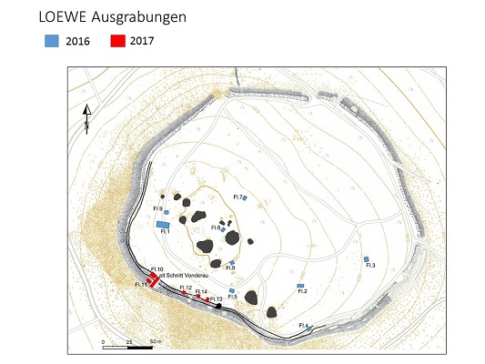 |
|
| Picture 1: Areas investigated in 2016 and 2017 on Mount Stallberg (H.Blitte) | ||
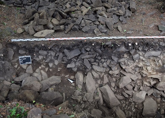 |
The goal of the current investigations was to get a dating for the stone wall and the acquisition of new data on the function of the mount during prehistoric times. Thus, an old trench conducted by Joseph Vonderau in 1903, was reopened and accompanied by new trenches on the inner side of the wall. A lot of finds, especially sherds of pottery, where unearthed. It seems that the stone wall acted as a backdrop for a colluvium. Most of the finds originated from trench 10, where a pit could be identified within the profile. | |
| Picture 2: Pit in the profile of trench 10 (Photo H.Blitte) | ||
| Soil samples for archaeobotanical investigations were taken from this pit but also from other locations of interest. Like in 2016, many sherds and silex fragments could be attributed to the late Neolithic. Among them are several pieces of Ösen, which probably belonged to the so called “Ösenkranzflaschen”. Within the ceramic spectrum, are further sherds that belong to the metal ages, more precisely the late Bronze Age and/or the early Iron Age, while some others are of medieval origin. | 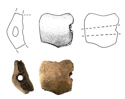 |
|
| Picture 3: Ceramic sherd from a late Neolithic “Ösenkranzflasche” (Photo B.Voss) | ||
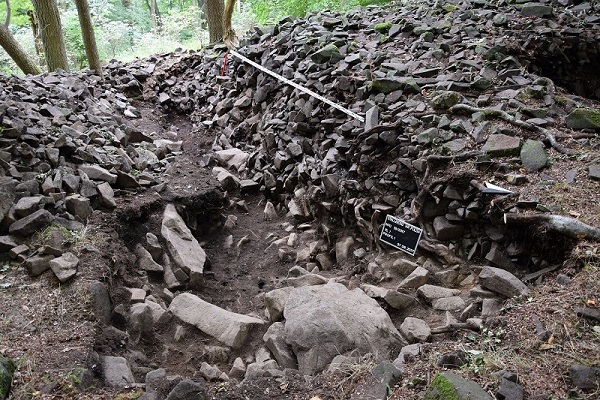 |
The largest trench from the campaign was cut through the collapsed wall. It was 12 m long and more than 2 m deep . Unfortunately it remains unclear whether the foundation of the wall was reached or not, since a row of big stone blocks made further investigations impossible. The front of the wall seems to be set from long rectangular shaped stones, which were already uncovered by Joseph Vonderau and have been documented again during the current campaign utilizing modern techniques of documentation. | |
| Picture 4: Trench through the collapsed wall (Photo H.Blitte) | ||
| In contrast to the descriptions by Vonderau, no traces of a “Pfostenschlitzmauer” had been identified. Further there were no evidence for structures on the inner side of the wall. This led to the impression that the construction was conducted by raising a big amount of loose stones in a ramp like fashion. | 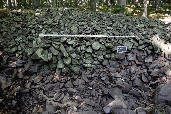 |
|
| Picture 5: Front of the stone wall (Photo H.Blitte) |
The chronological attribution of the wall is still unclear but will be clarified through radiocarbon dates from charcoals and burnt seeds sampled during the excavation.
(Authors Hélène Blitte and Rüdiger Krause)