


The excavations at the Late Bronze Age mega-site of Sântana near Arad, Romania 2018
The huge fortification of Sântana is located north of the Mureş River in the plain of the Mureş Basin, i.e. in western Romania, about 25 km north of the city of Arad. In 2018 the LOEWE-project started a cooperation with the Arad Museum and installed a joint scientific research program (large scale geomagnetics, lidar scans) and a second excavation after a first brief rescue excavation in 2009. With an area covering over 80 hectares and three fortification rings, the fortified settlement of Santana is the second largest mega-site following Cornesti-Iarcuri in the Romanian Banat south of the Mureş river.
The fortification already drew the attention of the Austrian authorities as far back as the eighteenth century. The fortification is already featured on the first Josephine topographic map. During the 19th century several scholars from Arad have described the ramparts and ditches of the fortification rings, attributing them wrongly to the Migration Period of the first millennium AD, namely to the Avars. It was only in the middle of the 20th century that a team of archaeologists from Arad and Cluj-Napoca proved that the fortification had been build during the Late Bronze Age. New archaeological investigations of the site “Cetatea Veche” began in 2008.
The results from the archaeological excavations, linked with the distribution and character of stray finds collected from surveys are painting a picture of a dynamic fortification that encloses an area of over 80 hectars. The fortification systems consisting of three large earthen ramparts with palisades and defensive ditches were constructed during the 15th century BC. They probably styed in use until the end of the 13th century BC. The numerous surveys performed on various occasions provide solid indications of an intense habitation. This is reflected by numerous items made from gold, bronze, and copper, by pottery fragments, and the burnt remains of cerveral large-size structures.
As a consequence, during July 2018, the Arad Museum together with the Goethe University of Frankfurt and the Institute of Archaeology from the Cluj-Napoca University, did initiate a series of multi-disciplinary investigations in Sântana “Cetatea Veche”. These consisted of an excavation and documentation aiming at the third fortification ring together with more geomagnetic measurements, a lidar scan and a series of aerial photographs as part of the LOEWE focal point “Prehistoric Conflict Research - Bronze Age hillforts between the Taunus and Carpathian Mountains”.
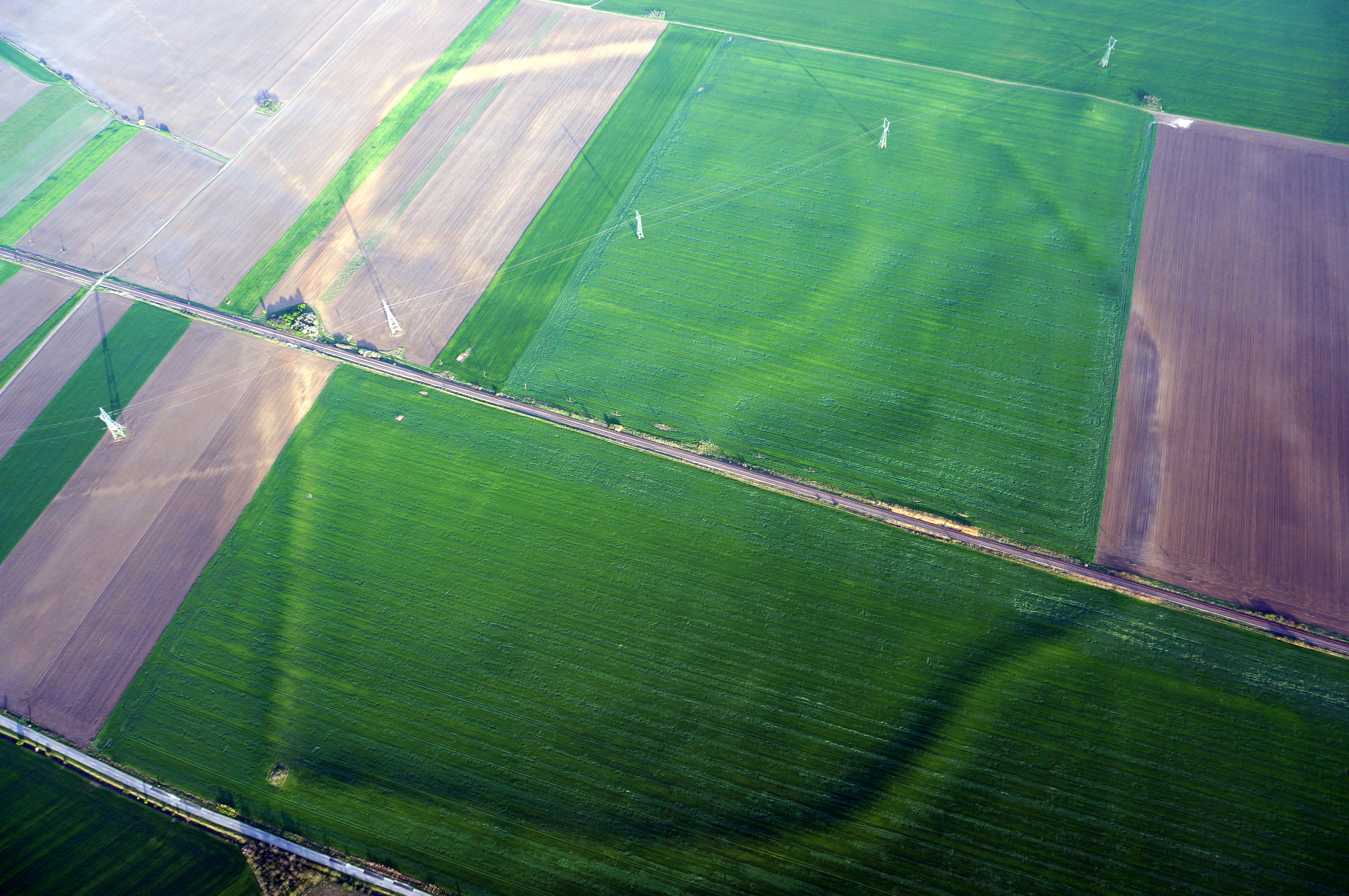 |
| Figure 1: Areal view of the fortification at Santana. The various rings of the fortification systems are clearly visible. |
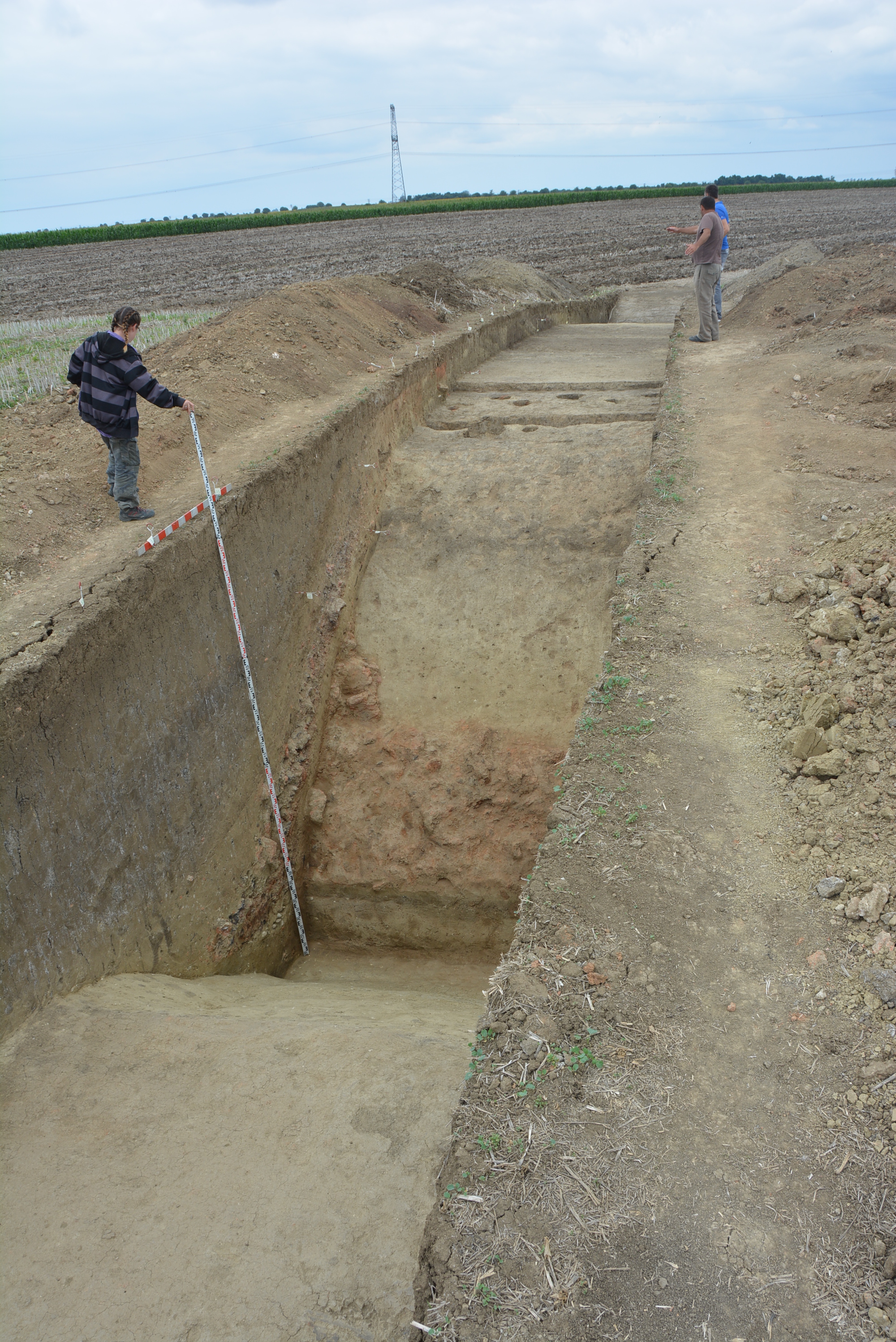
The archaeological excavation of 2018 consisted of a single trench measuring 65x3 m, located towards the north-eastern corner of the third ring. As a result we can state, that it has led to the identification of a complex fortification system consisting of two deep defense ditches and a large-size earthen rampart with the remains of a palisade made of wood and clay on top.
 |
 |
|
| Figure 2: The excavation trench from 2018. Showing the relations between the two ditches and the earthen rampart. | Figure 3: The scattered adobe rubble inside the trench. |
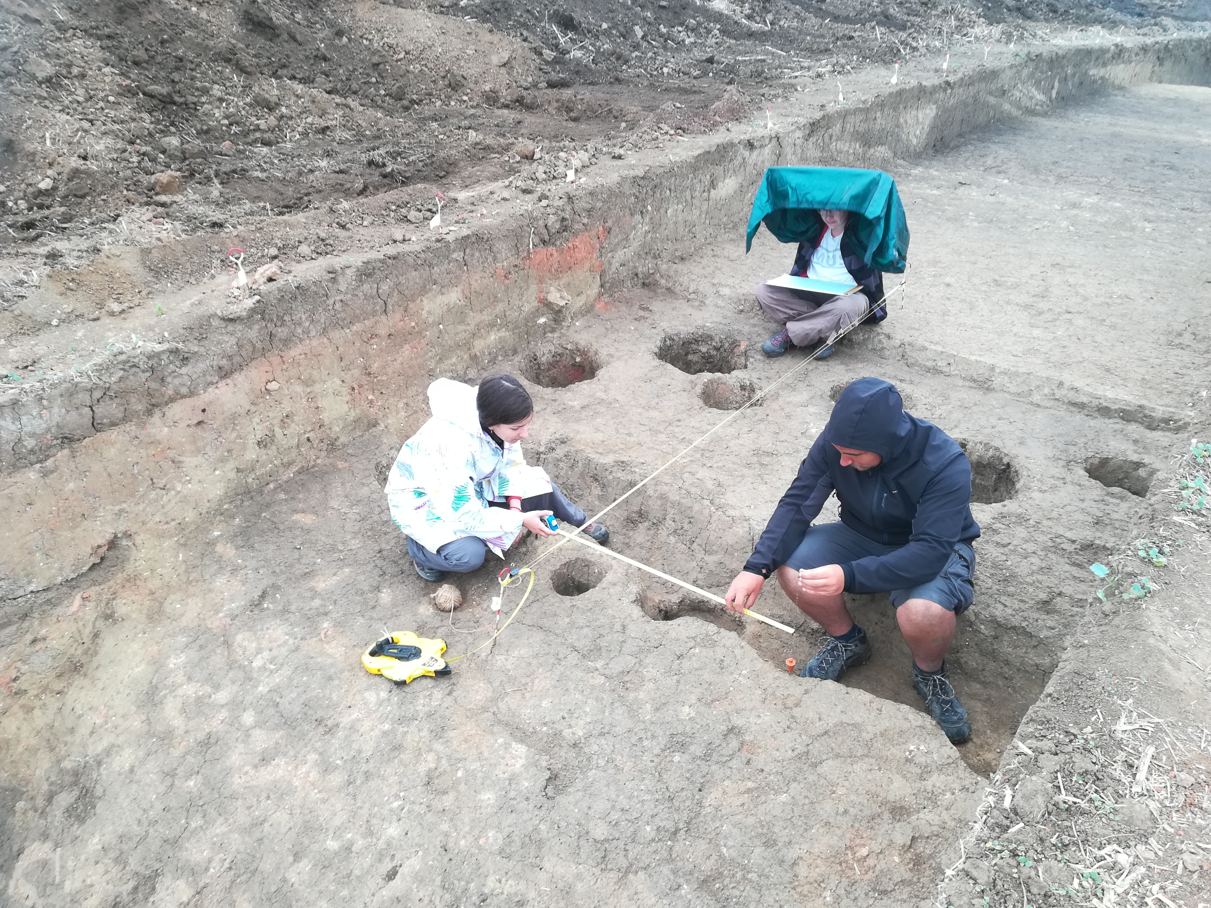
Some of the main goals of the 2018 archaeological excavations was to set up a chronology of the third fortification by gathering 14C-Dates. The rampart was built from compact soil and on top the strongly charred remains of the wooden palisade mixed with burnt adobe originating from the former construction. After the removal of this layer we found a series of postholes, placed in a zigzag pattern. Based on the analysis of the fragments of adobe, that show impressions of wood, and the postholes: We can state, that the structure, which was of considerable size, consisted of posts connected through a network of twigs (wattle) and wooden planks that were subsequently covered with adobe.
 |
 |
|
| Figure 4: Recording the zig-zag shaped postholes atop the rampart. | Figure 5: Another impression of the first ditch. One can clearly see the remains of the burnt fortification in the foreground and the postholes atop the rampart. |
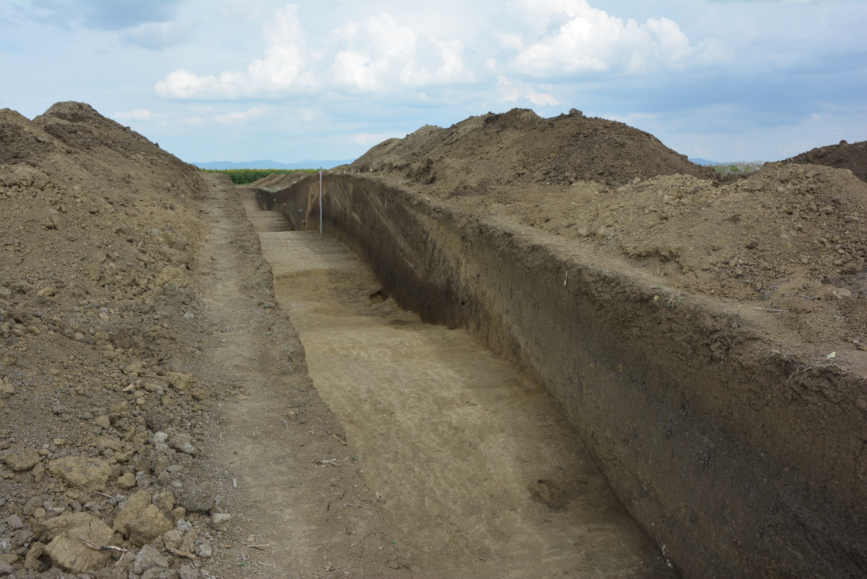
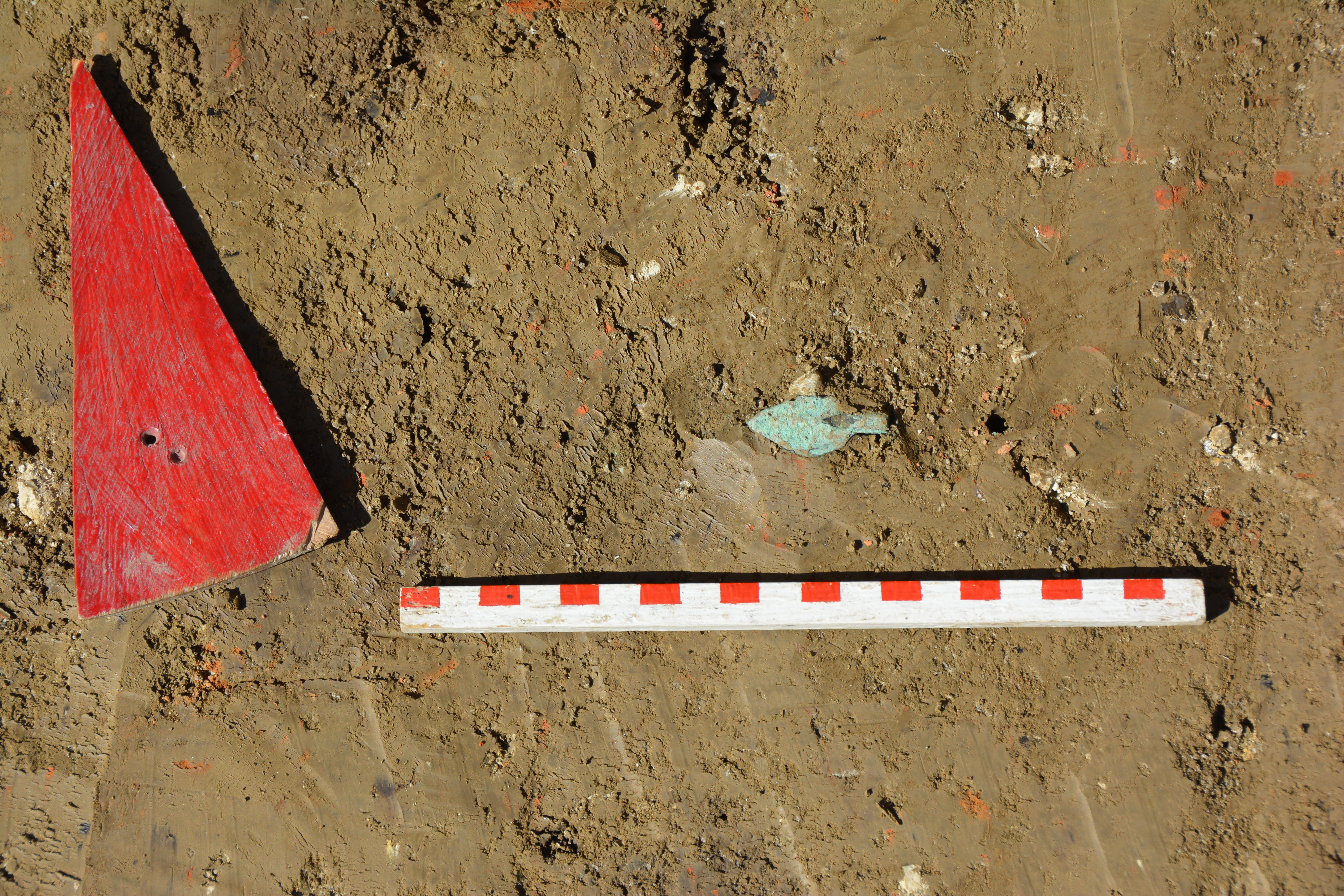
Numerous clay sling projectiles were found among the remains of the palisade. They come in different shapes (circular, conical, triangular, and rectangular). Another part of the fortification system are two wide and deep ditches. The first reaches the base of the rampart, into which the burned remains of the palisade and other artifacts such as a bronze arrowhead were fallen. The second ditch is located approximate 15 m in front of the first ditch. Both ditches together with the palisade on the wall, might have been an effective defensive construction.
 |
 |
|
| Figure 6: The construction of the rampart becomes evident in the profile. | Figure 7: In situ photograph of the bronze arrowhead from ditch one. |
The excavation of summer 2018 confirmed our assumption that the fortification fell during a violent battle and was subsequently burned down. The burned remains of the fortification have fallen into the first ditch. Hundreds of sling projectiles made of burned clay as well as a bronze arrowhead were recovered during the excavations in 2009 und 2018. Obviously the sling projectiles, which might have been heated up heavily before they been used, were an effective arm to destroy and set fire to the wooden constructions of the fortification.
(Authors and Photographs Victor Sava, Florin Gogâltan and Rüdiger Krause 12.10.2018)