


Archaeological excavations on Mt. Kleinberg (Fulda district)
Within the LOEWE research project on Bronze Age hillforts in Europe, the eastern part of Hessen constitutes one of the main regions for archaeological fieldwork. At the beginning of the 20th century Mount Kleinberg was attributed as an Iron Age hillfort despite the lack of any archaeological evidence. While the dating of the rampart and the use and the function of the mount remain uncertain caused by of the lack of excavations. Various surface finds have been discovered on the hilltop (originating from a field survey during the 1980’s), including the fragment of a spearhead from the Younger Urnfield culture. Several terraces could have served as a good base for the construction of houses. Based on these these observations and the Late Bronze Age spearhead, the existence of a Bronze Age hillfort has been hypothesized.
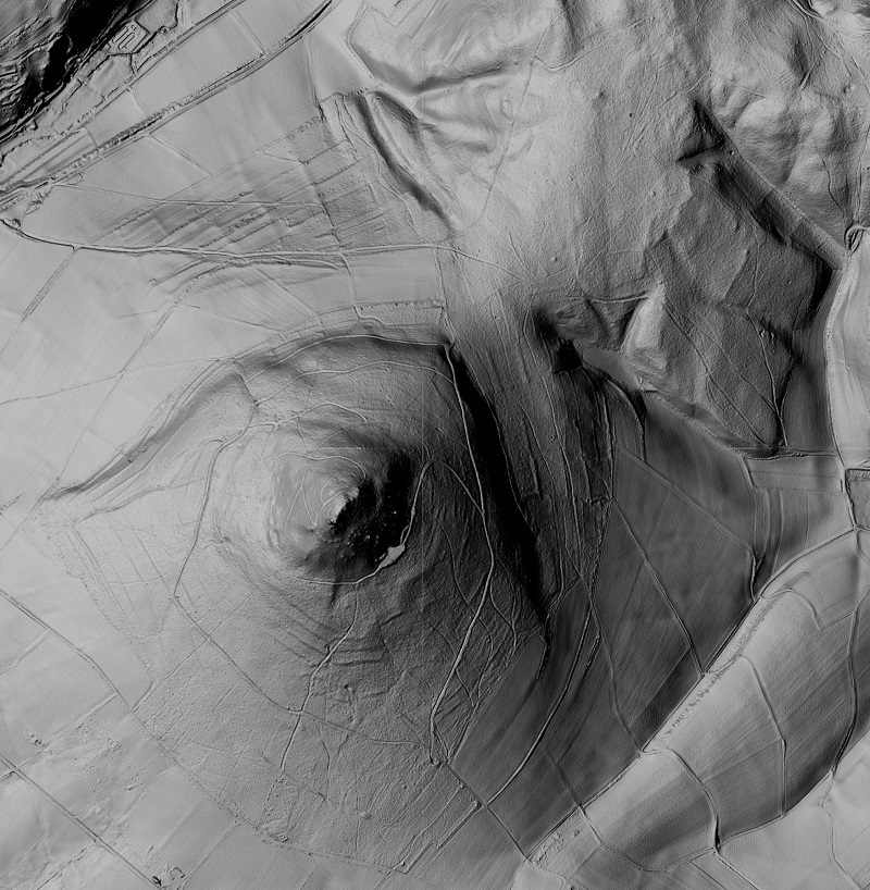 |
The Kleinberg is located approximately 10 km northeast of the town of Hünfeld and 3 km northeast from the Stallberg in the parish of Rasdorf within the Rhön Mountains. It is part of the Hessian ‘skittles’ and is 525 m asl. While prehistoric ramparts are present on the summit, some burial mounds are located on the footslope. The plateau is surrounded by a wall made from lokal basalt enclosing an area of 1 ha. This stone ring was considered very late to be a fortification wall, in comparison to other fortified sites. |
| Picture 1: DGM of the Mt. Kleinberg (bodenviewer.hessen.de - © GeoBasis-DE / BKG 2013, Hessische Verwaltung für Bodenmanagement und Geoinformation) |
|
Prior to the excavation, two surveys took place within the enclosed surface during autumn of 2016: 150 prehistoric ceramic sherds and 12 late medieval ones had been collected. Moreover, 47 metallic objects where discovered while most of them remain without dating (Lotz, Rößner 2017). |
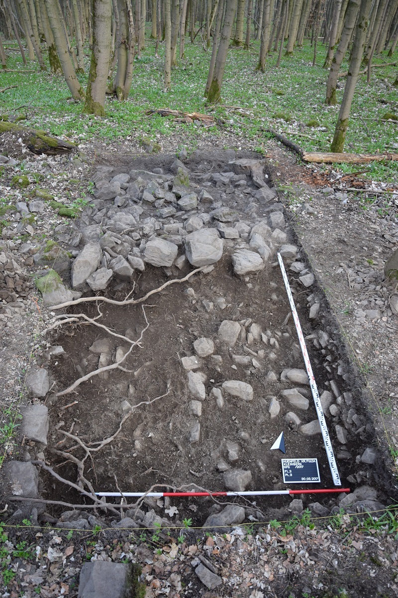 |
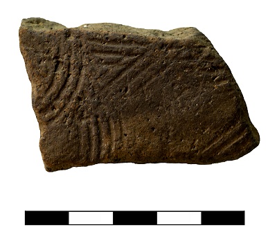
Between March 21th and April 13th, 2017 excavations took place on Mt. Kleinberg in cooperation with Dr. F. Verse, head archaeologist for the town of Fulda, and the excavation company SPAU from Münzenberg. During the course of this campaign, 4 areas of approximately 63 m² in total have been investigated. There was no direct evidence of human activities since all the cultural layers seem to have completely eroded. The bedblock have been reached in each area after the first planum. Archaeological objects were mainly found in plot 2 and 3, which were located inside the stones ring. The other plots contain fewer material. This material is mainly composed of ceramic sherds of different size and a single fragment from a grinding stone. Two ceramic sherds with comb décor (Kammstrichverzierung) proof that the mount had been occupied during the Early or Middle La Tène Period. Soil samples were taken for archaeobotanical analysis and revealed some macro-botanical remains. There are to be analysed and if meaningful, also dated. The trench in the northeastern part of the possible wall (plot 2) did not provide any proof of a structure, which means that the stone ring might have been formed through a natural process. |
| Picture 2: Plot 2 (Photo H.Blitte) |
Soil samples were taken for archaeobotanical analysis and revealed some macro-botanical remains. There are to be analysed and if meaningful, also dated. The trench in the northeastern part of the possible wall (plot 2) did not provide any proof of a structure, which means that the stone ring might have been formed through a natural process.
 |
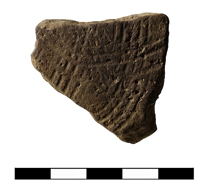 |
| Picture 3: ceramic sherds (Foto: B.Voss) | |
The latest investigations into the Kleinberg demonstrate a certain density of Iron Age finds. The question if a fortification was established on the hilltop remains open. The use of the plateau during prehistorical times has been proven but its function, particular in relation to its neighbour Stallberg, remains uncertain.
(Autoren: Hélène Blitte, Frank Verse, Rüdiger Krause)
Bibliography
Lotz C., Rößner S., „Der Kleinberg zwischen Rasdorf und Eiterfeld-Kirchhasel (Lkr.Fulda)“, Kleines Archiv für die Archäologie im Landkreis Fulda, Ausgabe 2/2016, Jahrgang 1, Fulda, 2017