


Geophysical survey at Teleac (RO)
At the end of May and early June 2016 the project conducted a geophysical survey of the Late Bronze and Early Iron Age fortified settlement of Teleac, 5 kilometres northeast of Alba Iulia in southwestern Transylvania. With an estimated 30 hectares and a circumference of 2300 meters Teleac is the largest hillfort in the region.
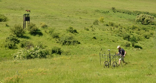 |
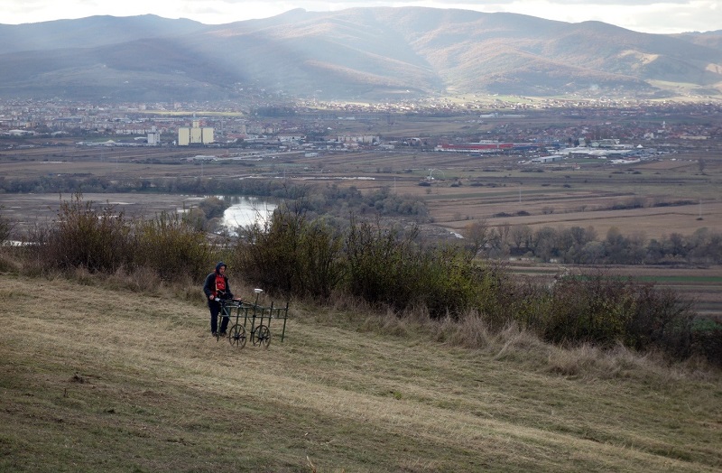
Using a five channel Sensys MX-5 DGPS magnetometer, we surveyed 12 hectares in different parts of the site with focus on open fields inside the hillfort and in search of habitation areas outside the northern fortification system. |
| Picture 1: Surveying north of the hillfort |
| The magnetogram shows intensive settlement activities in all investigated parts of the hillfort with anomalies indicative of pits and oval pit-houses found during previous excavations of the site. The immediate area outside the northern part of the hillfort appears mostly empty, and signs of habitation first appear at a distance of a few hundred meters from the fortifications. |  |
| Picture 2: Core sampling of anomalies found during the survey |
We use the results of the survey when choosing where to excavate this summer. The plan is to open a 10 x 10 meter trench in the northern part of the hillfort, which may be extended to investigate the extent and relationship between any found architectural remains, areas or features that can tell us more about the internal structure of the site. We will also investigate the nature of what appears to be signs of habitation outside the hillfort.
Excavations at Teleac 2016 (RO)
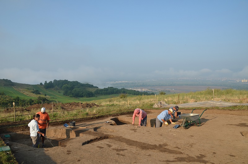
| The Teleac hillfort is located on the east bank of the Mureş river in southwestern Transylvania. The settlement was established in the 11th century BC and occupied until the 8th century BC, or from the early phase of the Gáva culture to the Basarabi culture. Teleac is heavily fortified. The western and north western sides are formed by steep natural slopes and the southern side is demarcated by a sharp ridge. The southern ridge and western rim is connected by a seven meter high and more than 600 m long ditch and rampart, thus creating a fortified area of 30 ha. | 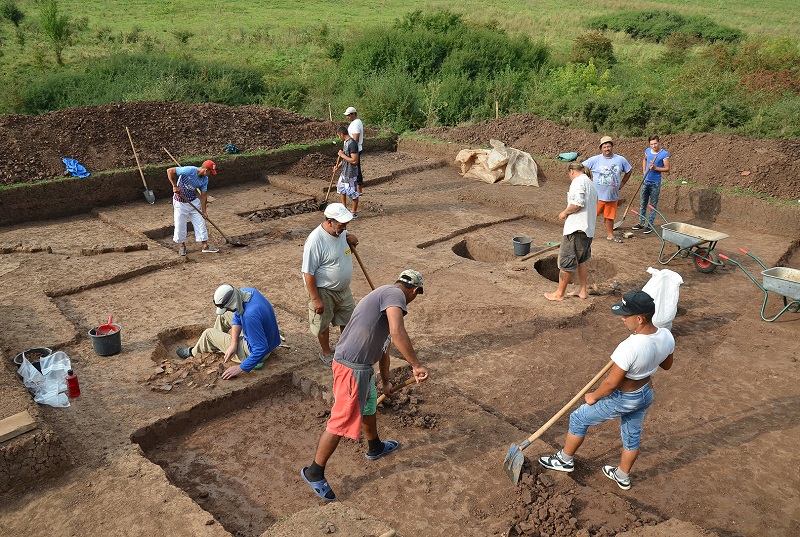 |
| Picture 1: Excavating the Late Bronze Age horizon in the 20x20 m trench |
 |
In 2016 the Romano-Germanic Commission and the National Museum of the Union in Alba Iulia excavated from the end of June to early September. Based on information from the previous geophysical survey we investigated a 20x20 m trench directly north of the fortifications and a 10x10 m trench in the northern part of the hillfort. The general aims are to study the internal settlement structure and local economy, as well as relating the defensive works to developments in the fortified and unfortified parts of the settlement |
| Picture 2: At work in two pit-buildings in the 10x10 m trench |
| The area of the 20x20 metre trench had several distinct anomalies, two of which turned out to be well preserved Early Medieval pit houses. Of more interest was the discovery of a surface building with a hearth in the centre, and a nearby beehive shaped pit which contained large fragments of a portable hearth. Pending 14C dating and further analysis of the ceramic material these finds appear to belong to a previously unknown Late Bronze Age horizon that just preceded the establishment of the hillfort, and they provide valuable information for the understanding of the site’s history. | 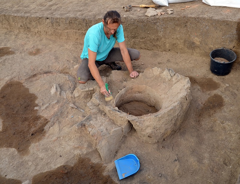 |
| Image 3: Excavating the pottery kiln |
 |
The 10x10 metre trench inside the fortifications contained several pits, two sunken buildings and a production area with five fire installations, including a well preserved pottery kiln and a large oven with ventilation holes along the bottom sides of the hemispherical superstructure. The pottery kiln was presumably for production of fine ware ceramics, whereas the function of the oven and other fire installations is more uncertain awaiting further analysis. The finds in the 10x10 metre trench gives important data concerning local production in Teleac and insights in the internal organisation of the settlement. |
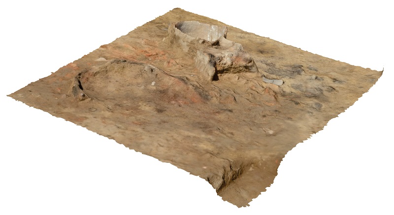
| Picture 4: 3D model of the pottery kiln |
| The summer campaign in 2016 has shown that there is a high accordance between anomalies in the magnetogram and the feature we have found during the excavations. This will help us to decide where we will open new trenches in 2017. | 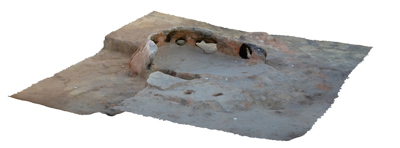 |
| Picture 5: 3D model of the oven |
Geomagnetic survey of the Teleac hillfort, autumn 2016 (RO)
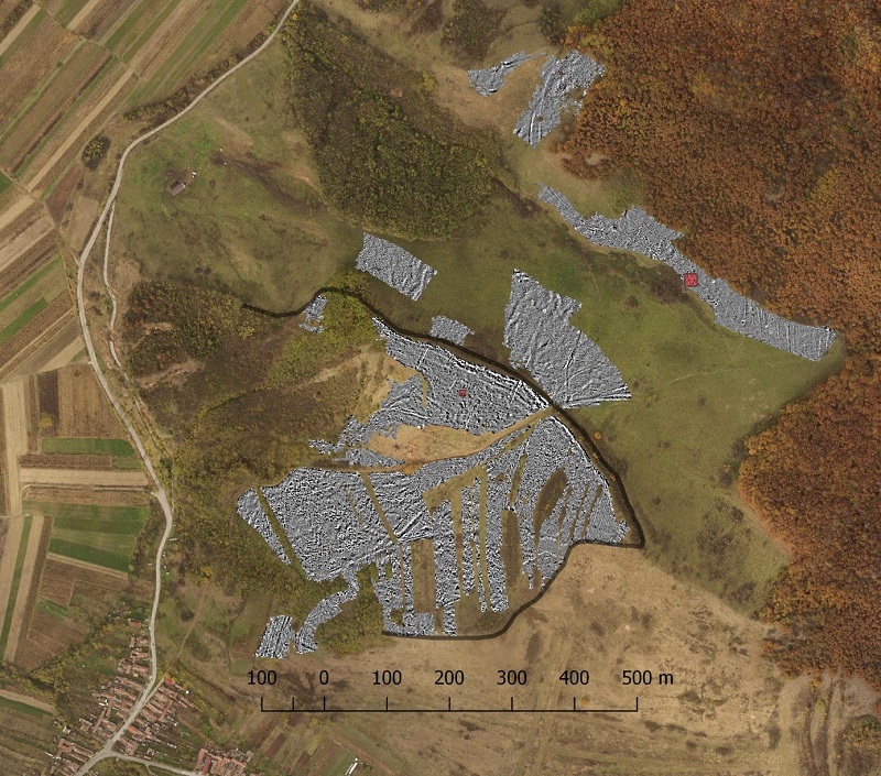 |
A second survey of Teleac was made in the autumn of 2016. This time we concentrated on geomagnetic prospection of the fortified areas to get a better understanding of the hillfort’s internal settlement structure. 20,3 ha have so far been surveyed, divided into 7,1 ha north of the settlement and 13,2 ha inside the fortification system. |
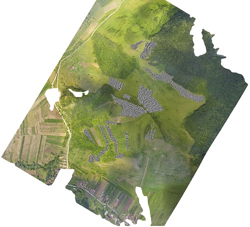
| Picture 1: The magnetogram superimposed on an orthophoto of Teleac. The outline of the fortification system is marked in black and the two trenches excavated in 2016 in red. |
|
The excavations we carried out in the summer of 2016 made evident that there is a high agreement between anomalies on the magnetogram and archaeological features. This enables us to use the excavated features as a baseline for understanding geomagnetic anomalies at other parts of the site to gain insights into the hillfort’s settlement structure. The magnetogram shows intensive settlement activities with anomalies indicative of pits, various fire installations and small sunken buildings in almost all parts with flat terrain in the hillfort, and the up to 2 m deep cultural layers in the same general areas demonstrates the long-term nature of these activities. |
 Picture 2: Geomagnetic survey |
 Picture 3: Collecting soil samples |
There are however some noticeable differences between various parts of the hillfort. The lower settlement appears to have had the densest occupation, whereas uphill areas had a more dispersed building pattern. The northern part of the site stands out with a concentration of anomalies resembling pit-buildings along the rampart and a large area further south that may have been used for high-temperature production activities. It therefore seems that various areas of the hillfort were used for different activities. |