


Geophysical Prospections Winter 2016
In the framework of the subproject of the Romano-Germanic Comission on hillforts in Hesse geophysical prospection were conducted on a couple of sites by Posselt & Zickgraf Prospektionen GbR. Based on the of archive sources and terrain models generated from LiDAR-Scans (Light detection and ranging) promising sites were chosen (Hünerberg, Bleibeskopf etc.) for investigations with geomagnetometry and georadar.
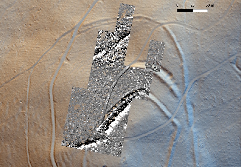 |
The aim of the fieldwork was to evaluate the preservation of archaeological features and potentially identify remains of architecture. The measurements will be the basis for further examinations of some of the sites. Dense vegetation and rugged landscape made the investigations a challenging task, but on most of the sites the results are highly promising as could be seen in the case of the Brüler Berg (Picture 1) |
| Picture 1: Brüler Berg. Magnetogram (made by M. Posselt) above a Hillshading from multiple directions made with Relief Visualization Toolbox (data: DGM 1 © Hessisches Landesamt für Bodenmanagement und Geoinformation; D. Neumann) |
| On this site which is characterized many ramparts linear anomalies which are highly probable larger archaeological features were detected. In correspondence with the terrain data without any intrusions on the site already insights into the structure of the sites was possible. The investigations will be carried on in different sites in the coming winter. | 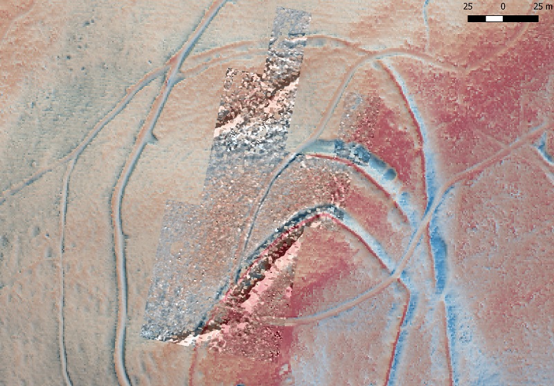 |
| Picture 2: Brüler Berg. Magnetogram (made by M. Posselt) above a Hillshading from multiple directions and Sky View Factor (see Picture 1). |
(Author: Daniel Neumann)